Day 11, 28 Jan, Nhill to Lake Albacutya
I had not really assessed today’s bike ride properly during solo birthday celebrations in the motel the previous night. After leisurely buying food in Nhill, Google revealed a 102 km bike ride just to get to the entrance of Wyperfield National Park. This was significantly longer than expected and was a bit of a wake-up call. In preparation for this and a possible two further days without reliable water, I filled my water bottles and dromedary bag to the point where I was carrying more water than I had ever carried on the bike. The ride began great, the southerly wind helped along the flat empty dry farmland.

Gradually my squadron of flies accumulated and it was time for the head net.

The wind strengthened and shifted westerly making cycling more challenging and picking up dust in gusts whipping across the dry fields.


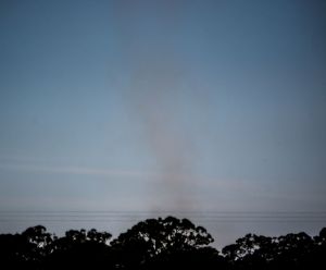
Occasionally a dust vortex was created in the strong winds. The formation mechanism being completely different to a traditional dust devil as they form in light winds.
By afternoon the town of Rainbow approached. I expected very little from this town but was surprised to find it to have several shops, a bar, and a motel. Lugging tonnes of water 71 km from Nhill had been pointless, I really should check maps more thoroughly before venturing off.

Just north of Rainbow a stick in the road started slithering as I approached and it required a swerve of the bike to avoid it. Hastily grabbed the camera to get a picture of it escaping. Not sure what species, but assumed poisonous.

After this I overshot a dirt track turnoff by 2 km and had to back track to the track which began with an atmospheric grain storage building.

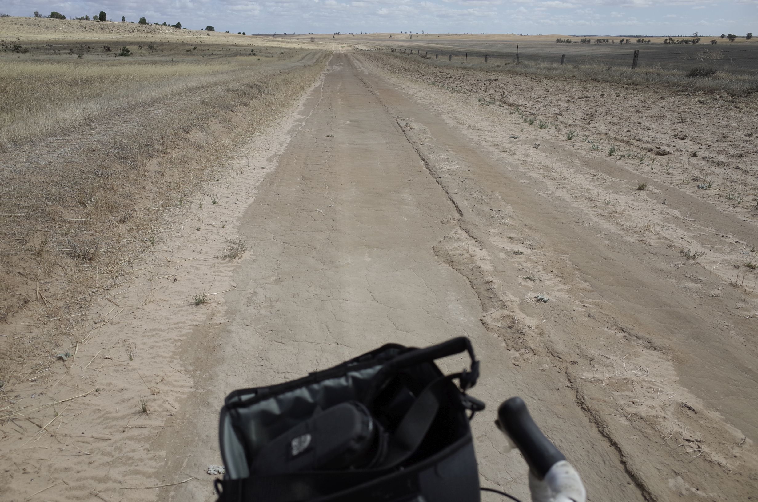
The track was fine for cycling and lead north along the eastern shore of dry Lake Albacutya.

About 20 minutes along the shore a track lead to a deserted camping area where I spent the evening watching the sunset and eating dinner. It was an impressive place with a huge sky above the completely flat large dry lake.


The time-lapse below is a combination of both the Ricoh GR and the Sony NEX-6 (zoomed parts). Absolutely nobody anywhere.
Day 12, 29 Jan: Lake Albacutya to Wonga Campground
After packing up at Lake Albacutya the route continued north on the dirt track along the eastern side of the dry Lake.
First problem was I overshot a junction, did not see it at all. I re-routed and another track east was chosen by the Google God. It required a search to find it as it did not even meet the track I was on but instead began over a fence in nearby farmland. I was beginning to understand why cycling directions in Google were to be “used with caution”. I had to walk the bike through a grass area to a rusty gate, gingerly searching for snakes on the way. The gate however was not an opening gate -of course duh!- so all the pannier bags and bike had to be lifted over to get to the track.

This was a bit concerning as I had no idea if this track would actually be rideable and also whether there would be more gates to clamber over. Well the track was unrideable for a lot of the start because of sand. I tried a technique of riding on the vegetation not the sand but this just caused more problems because it all got stuck in the wheel.

The sand ended after a bit and I could ride without exhausting work, however there was another unexpected surprise. From the top of a tiny hill the track lead into what appeared to be a small mine. Well I had no choice but to go through it. There were a couple of cars as well as mining machinery vehicles next to a small prefab building. As I passed it I looked in and amazingly there were actually a person inside. Not wanting to be caught trespassing I continued along the track that avoided the heart of the mine, however it soon dead ended and I had to back track to the prefab. At that point a couple of men had appeared and were working on one of the vehicles. I waved at them and they just disappeared behind the vehicle. I approached and very apologetically asked for the route to the Park Road. The man was fine about it and said just bike through the mine and you’ll get there. So in a somewhat strange situation I was biking through piles of white in a gypsium mine.

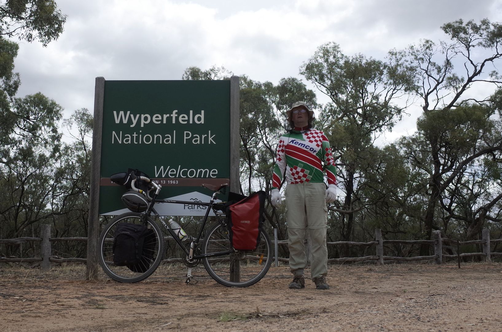
Beyond that to my great relief was the sealed, paved, tarmacked, whatever you want to call it, it was the Park Road that led to Wyperfield Park. What the hell, all this messing about getting lost meant I still wasn’t even at the park entrance and it was now lunchtime. Anyway biking on north now things were straight forward the park entrance appeared after a bit.
I noticed that my back tire was very flat, hmm, but it was a slow puncture so I pumped it up and after a few more km made it to Wonga Campground. Well this place was a ghost campground, really large with 4 or 5 toilet blocks and an information lounge with displays but nobody anywhere. No more cycling today, I decided to stay at the campground and get my shit together. First of all there was my flat back tire.
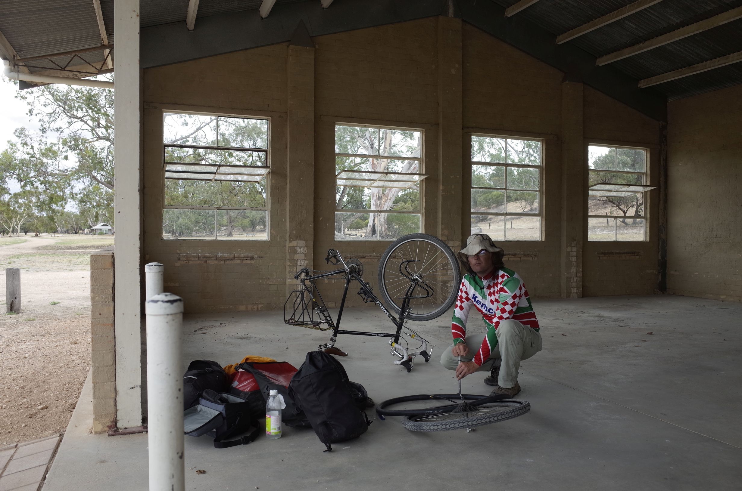
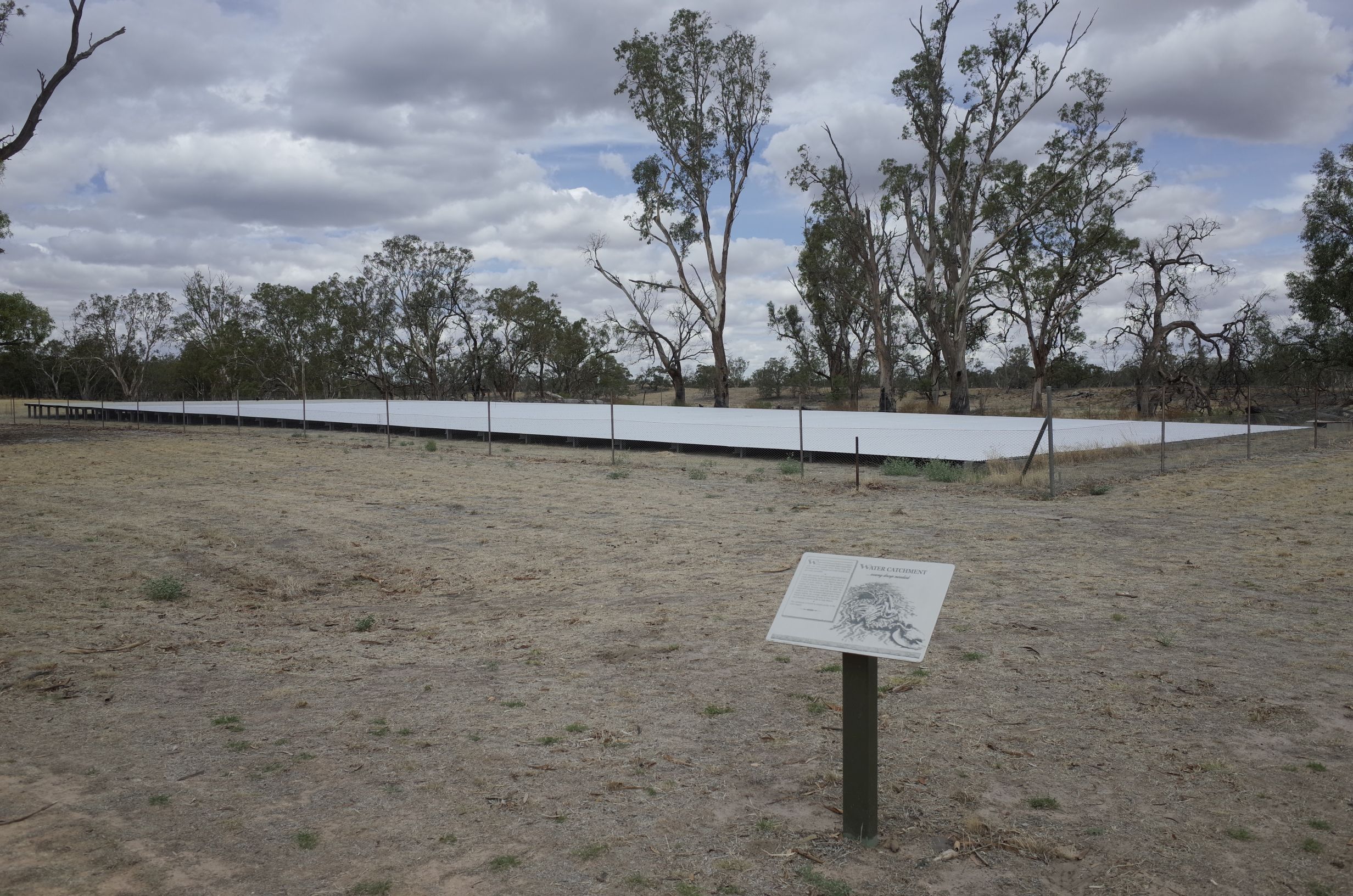
I found the puncture and fixed and then removed eight small thorns from the tire, I suspected from that little escapade trying to ride off the sand earlier. Also fixed another puncture on another tube. It seemed initially that there was no water here (no mobile reception either) as none came out of the taps. However after turning another large tap on the water storage container, voila! Running water, albeit not drinkable according to the signs. Found that actually they have a massive water collection facility, just a giant corrugated roof that runs into two large concrete bunkers.
I spent the rest of the day enjoying the continued isolation and making a time-lapse of the sun through the overcast sky.
Eventually set up tent on an ants nest and fell asleep watching them wander across the netting.
Day 13, 30 Jan: Wonga Campground to Western Dune
After packing up the first thing I did was bike round the James Barret Nature Drive. This went to the eastern dune lookout where I learned about the different vegetation that occurs at different levels on the dunes. The river red gums are the lowest, their seeds bought in at the high water mark of the lakes that are now usually dry due to human intervention upstream. Next up are the incredibly successful black box eucalyptus and further up the dunes are Cyprus pines with mallee scrub eucalyptus on the top. Nice parrots hanging around too.

On the way back to camp I realized my front tire was going a bit flat, another puncture surely not. I just pumped it up a bit, lower pressure was good anyway on the rough tracks. On arrival at camp it dawned on me that the information centre might well have a plug where I could charge the laptop and cameras. Well it did so I did charge them. Outside I tried to charge the solar panel battery but crap it seemed to be completely unresponsive. This was a potential deal breaker because that battery was critical to recharging the cameras for the battery intensive time-lapses. I tore the connection box apart with my Leatherman and messed about randomly with the wiring, no doubt completely voiding the warranty. While doing this I noticed that my back pannier had ripped off at one of the screws.

Come on! Everything seemed to be breaking, thankfully after initial frustration this was easily fixed after finding a screw had fallen off into the pannier. Back to the solar panel, well my fiddling eventually got some dodgy response and it was able to charge if placed and checked carefully.
Right so what to do next. I wanted to go north through the park to the other side and the best way appeared to be the “management vehicles and walkers only” “Freeway Track”. Was the name “Freeway” a sign of the quality or some strange joke, I did not know, I just headed towards it optimistically.
The track began with sand, and had sections of sand that required walking, however there was enough sections that could be cycled that I continued along it for about 10 km. However after getting about one third of the distance to the next camp, the track turned to deep sand and was completely unrideable.

After wandering along without the bike to check it out, it was clear that the sand did not end soon so I decided to turn around and return to Wonga Campground, again. Soon after turning around my dodgy front tire gave up and went completely flat. At the same time it started raining, and it got heavy. Wet sand was getting everywhere and it was a struggle to replace the punctured tube while sheltering under a bush and wearing poncho plus rain jacket (both not water proof incidentally) and head net.

I felt ridiculous and wondered what else could go wrong. Yikes!, the puncture was at the valve metal and looked irreparable,
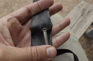
yup this tube was shot and had to be replaced by one repaired yesterday. I was running low of usable tubes. The replacement tube held but the bike was grinding painfully with wet sand in the chain for the rest of the ride and walk back to camp. Needed some food but found that this awful tuna paste had leaked and was over everything making it smell terrible. Tip: be careful with oily food stuffs that come in glass jars or bottles. They tend to leak even when the lid is on tight. I felt pretty despondent by this time, so many problems and basically back to square one, but I made a big load of grainy coffee and soon perked up. I knew I would have to leave the park the way I came. I resolved to get on Tinder and find a wife.
I decided to cut my toe nails, then “repaired” my handlebar tape by cutting off two of the pockets from my jockey shirt and using them.

After this I procrastinated over where to camp. On the map was the “Western Dune Lookout” that looked out across the very remote western areas of the park. I decided to try and get there, but it was a walking track for a few km so was not sure about it. So in the late afternoon as the sun was getting low I found myself biking and walking along a sandy track towards this dune with only the kangaroos for company (I don’t count flies as company).

Eventually got to the final climb and forced the bike up the steep sand to the top. As I did this my phone suddenly came alive with noise of some messages as reception became available for the first time since entering the park. Wow! This place was great and would be one of the top campsites of the trip. The bush here spread out into the distance, undulating on the dunes seemingly forever.
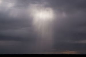

As the sun set a distant weak thunderstorm flashed occasionally somewhere in South Australia. I pitched the tent and made a surprisingly good meal before setting up a star time-lapse and going to bed, pretty darned tired after an eventful day.

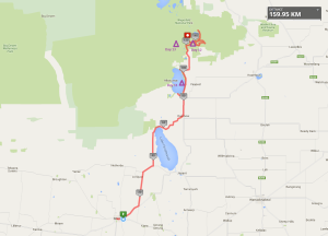
The route for these 3 days is here:
http://www.mapmyride.com/routes/view/988409923