

Day 9, 15 Mar: To the Waikato
The exciting goal today was to get on the mountain bike Waikato River bike trails which would lead towards Taupo. The Waikato River is the longest on the North Island. The two middle sections of this trail were rated advanced, for mountain biking, so I was interested to see what lay ahead. The road south from Te Aroha towards the Waikato was flat and easy. I found the river trail (http://www.waikatorivertrails.co.nz/ also http://nzcycletrail.com/trails/waikato-river-trails/) that started uninteresting by going along the side of the road. I would advise just cycling on the road for this section, that’s what I did. Then it got down to the river and wound along the side.

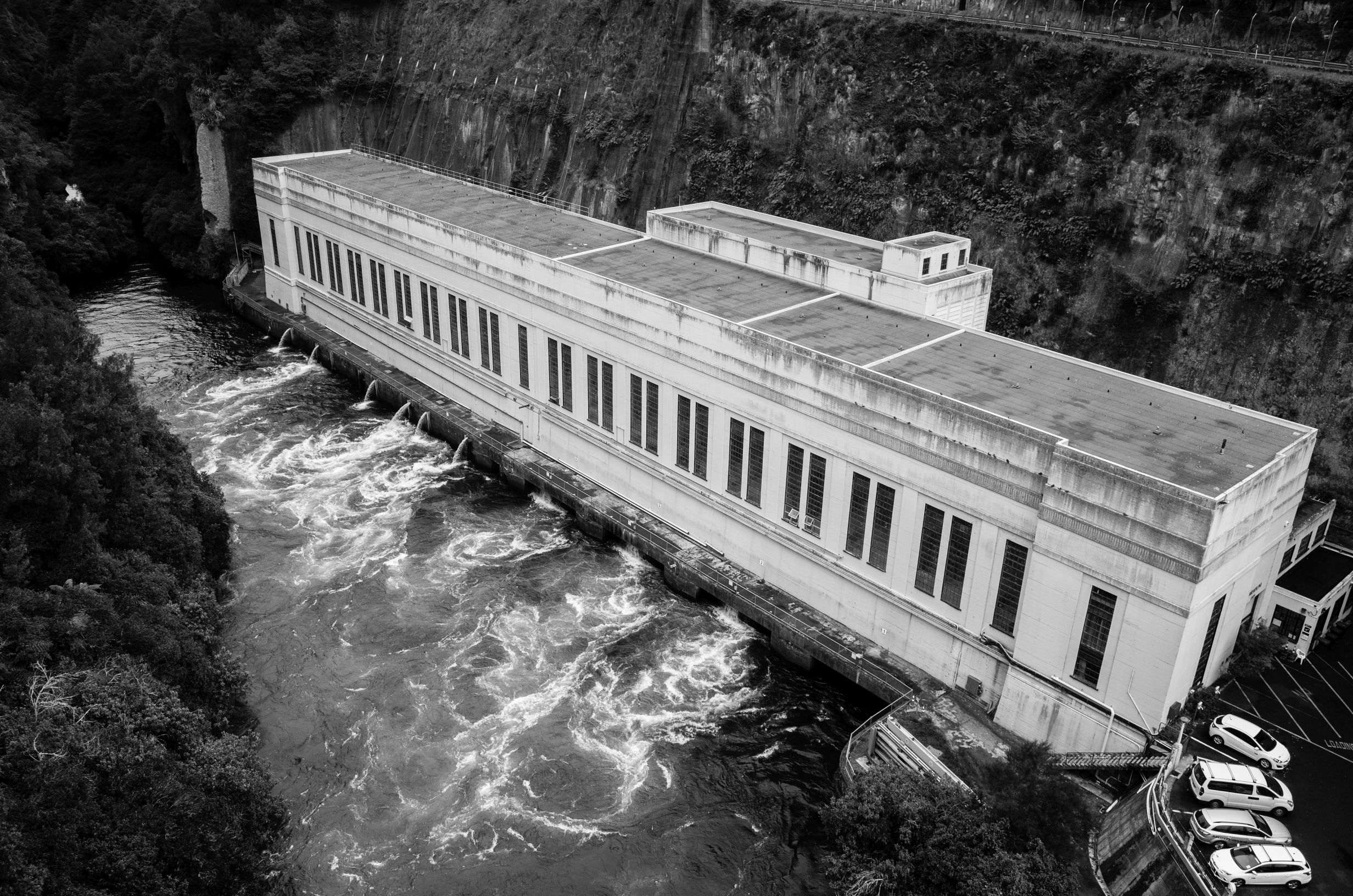
It was pleasant and easy with some cool walkway sections across swamp areas. It eventually lead to the Arapuni Bridge and then the dam.

I began the advanced second section. In the late afternoon and began a search for a campsite. I found a nice spot but it was absolutely riddled with mosquitoes after dark.

Day 10, 16 Mar: The Advanced Waikato River Trail sections to Mangakino
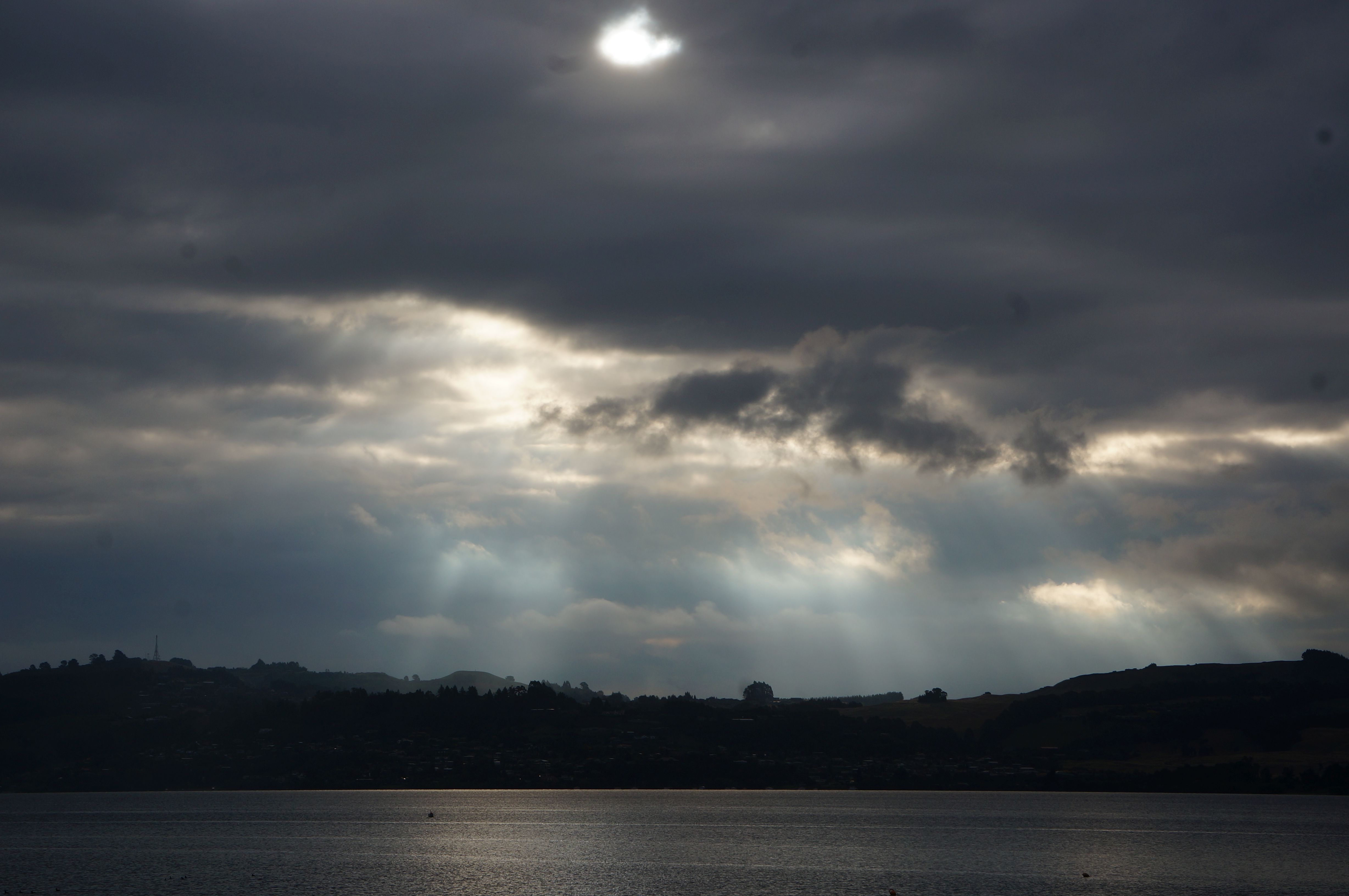
It was a beautiful misty morning over the river/lake by my camp, but my attempt at a time-lapse failed miserably so have to settle for a picture:

Today was the most technical cycling I had done on the Surly as the non-road sections were almost entirely on mountain bike trails. I had to do a fair amount of walking up some of the trickier switch backs. After the long road section there is a long steep descent back to the river.

I had a much needed bath in a tiny little stream
Crossing the Mangawera suspension bridge:

It was a week day but still I was surprised to have seen no cyclists whatsoever since the previous days afternoon. A section of note for tourers is a stair section where if you have a heavy load I would suggest removing your bags and carrying them down.

I did not and nearly lost control of my bike because the vegetation at the side was at times not enough to accommodate the panniers. Also tip: keep the bike pushed to the edge side of the tiny wooden ramp to avoid the back wheel falling off onto the stairs (which happened to me).
After about 25 km of mountain bike trails, at the end of section 2 I had hoped for some village or something to grab a pie, but instead just found the dam, damn! I was quite tired but opted to ride out the 19 km of advanced section 3 to get to Mangakino. This began on a tiring up and down, basically a walking track. I heard a machine noise in the forest and then saw a small golf cart type ranger vehicle chopping down a new, more direct track, so perhaps this bit will become quicker once completed. The second half of section 3 was easier with nice sections on pine needle covered tracks.
By the end though, I was starving, for some reason I had relied mostly on a morning coffee and a peanut butter sandiwich to sustain me for this strenuous day. I waddled into Mangakino and went straight into the first fast food place for a two “hot dog” (like a corn dog here), doughnut, nuggets, and chips combo, and proceeded to devour that down. Wandered to a nearby motel where I got a room, the place is a converted hospital, quiet, cheap, and perfect.
Day 11, 17 Mar: rest day in Mangakino hospital motel.
In the morning I decided to take a rest day and so spent the day just relaxing in Mangakino enjoying the empty motel and sleepy town. My Dad had contacted me about a relative in Taupo I could stay with named Clair Ellis so I decided on visiting her the next day.
Day 12, 18 Mar: Final Waikato section then route to Taupo (Clair’s)
From Mangakino completed most of the final section The rain during the night had left this section slippery and it was also rooty so some care was needed.


The clouds in the forested cliffs by the side of ****lake name** created a mysterious atmosphere so I took a quick time-lapse with the zoomed Sony NEX 6:
At times though it was just that perfect level of empty gravel path and fun corners that shifted me off into a semi-meditative state. I detoured off a few km before the end on a minor road (****road name?) to head to Taupo. The ride was then hilly and through pasture land and plantations and a geothermal station near the end.
On arrival in Taupo I tried to contact Clair by e-mail but then just decided (after a kebab) to go straight to her place. There we met and had a fun evening chatting with my never before met “rel” (Clair’s term for relative). She is my second cousin and has a really nice place, perhaps a bit too clean for my dirty self. Clair made a delicious omelette and we watched Graham Norton on TV, which was interesting because I had not really seen much TV, and especially British TV for some time and I’m pretty sure Graham Norton did not have white hair and beard the last time I saw him.
