
5 April 2016 (day 30): Turangi Lake Taupo camp to saddle hunters camp
The time had finally come to head west from Lake Taupo towards Taranaki. This had been my ultimate destination of this tour as Mt Taranaki seemed like the perfect mountain to time-lapse given its symmetry and exposure to storms. My intention was to cycle the Forgotten Highway to Stratford and then spend a few weeks in Taranaki exploring and time-lapsing the mountain. I expected a few hilly days to get there.
After packing up with the sand flies by the shore of Lake Taupo, I rode to a nearby lake park for breakfast and there I met Mel and Malcom, a camping van couple who invited me in for cake.

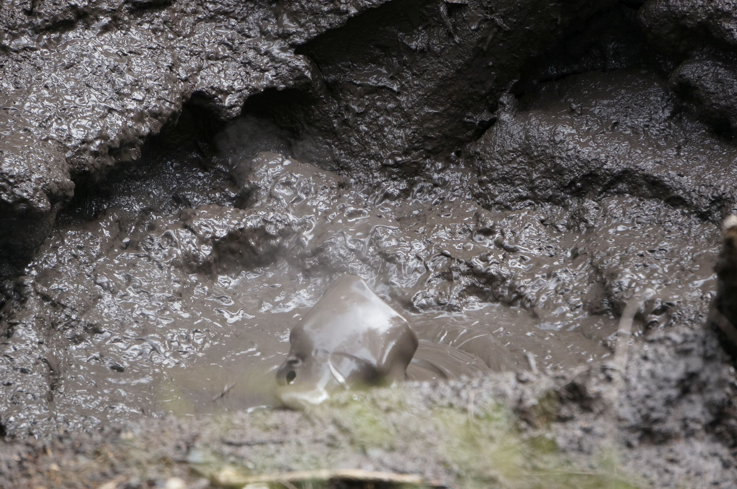
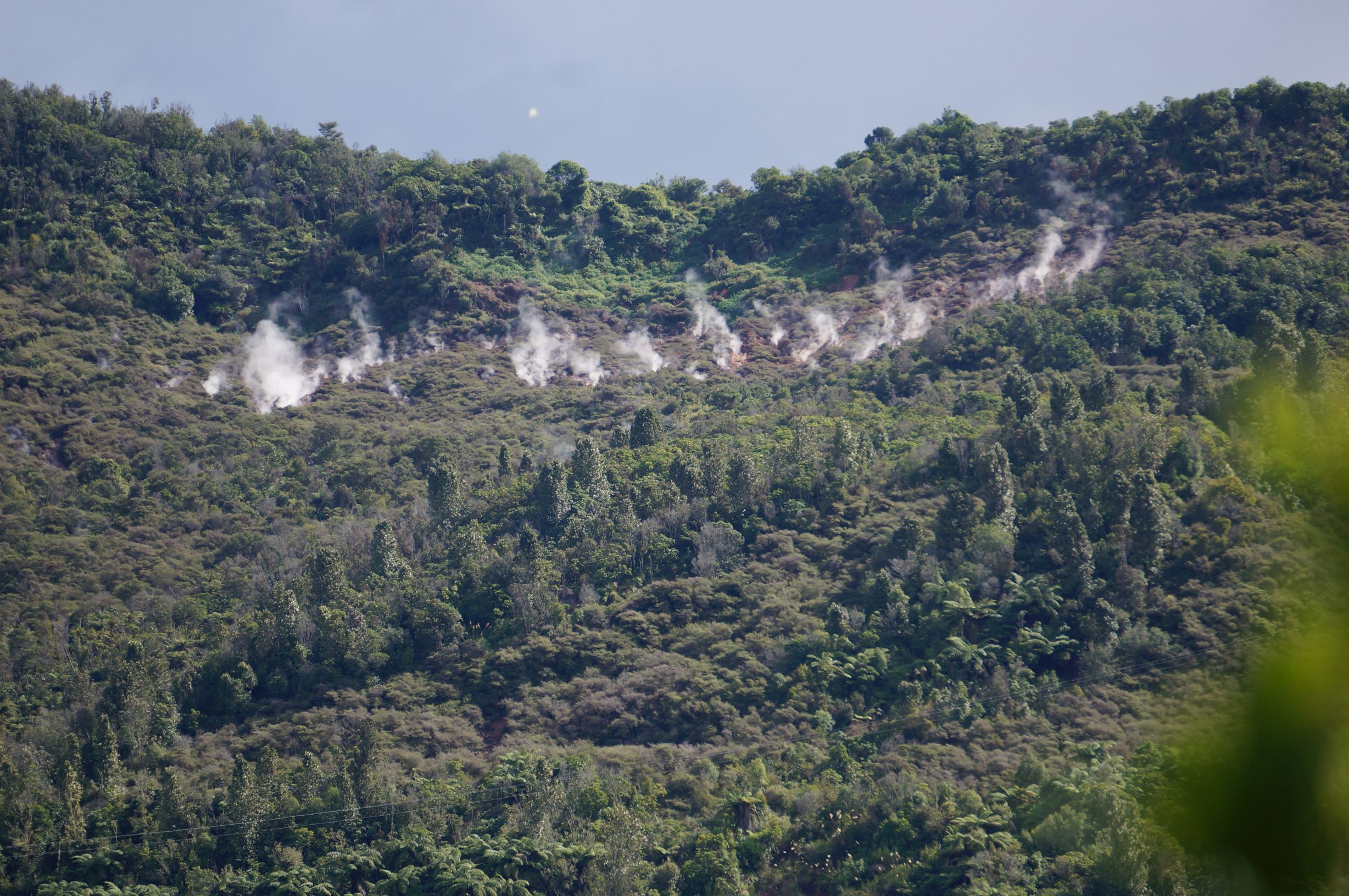
It was really nice to chat to some people and they offered me a stay on their farm in Manganui. From there I got food in Turangi and then rode towards the Tokaanu thermal areas, the upper sections I’d time-lapsed on 26 Mar in the video below:
A very accessible short walk here went past boiling pools and puddles of bubbling mud.

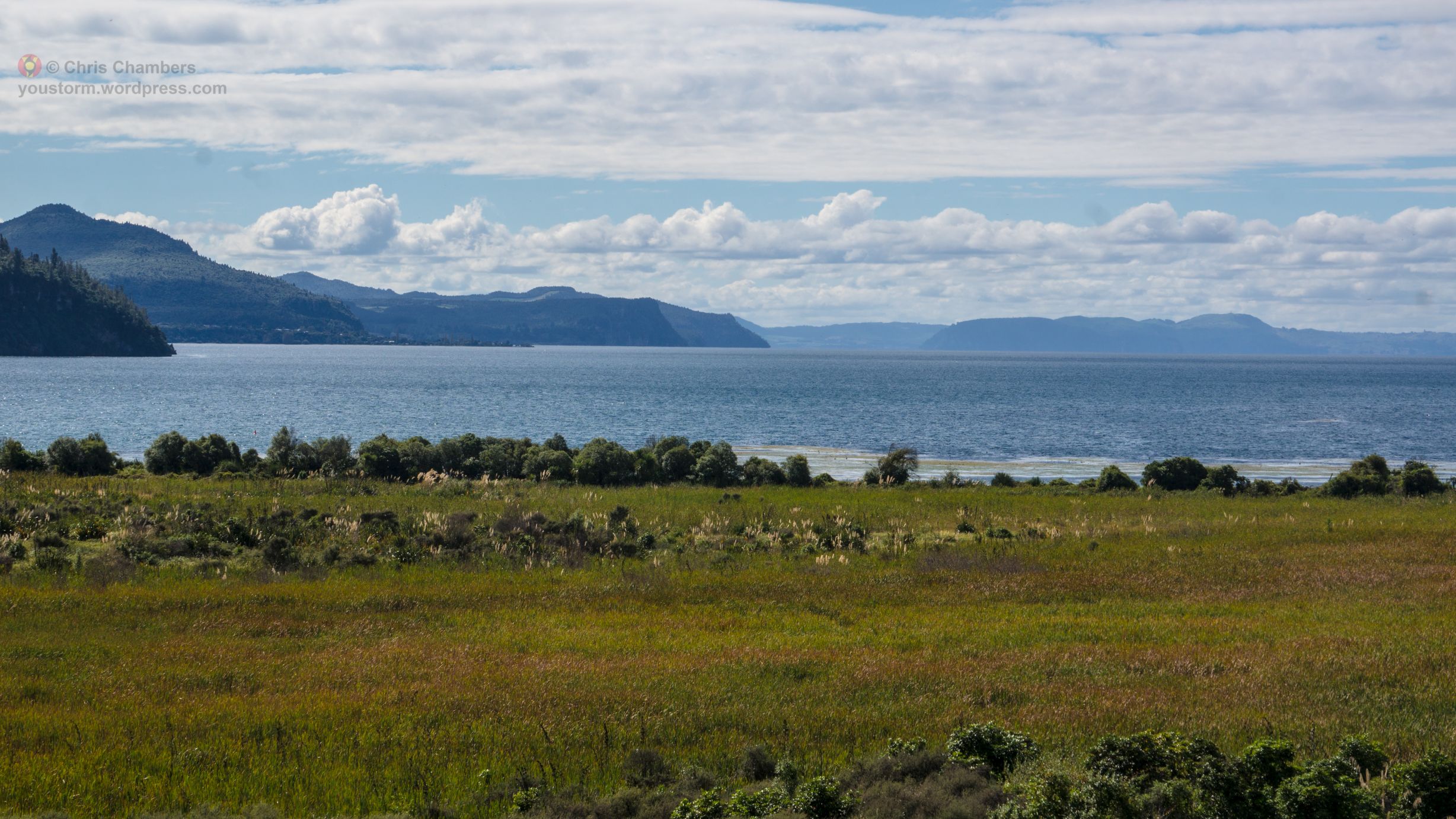
From Tokaanu the climbing began, first around the southern slopes above Lake Taupo and then away west.
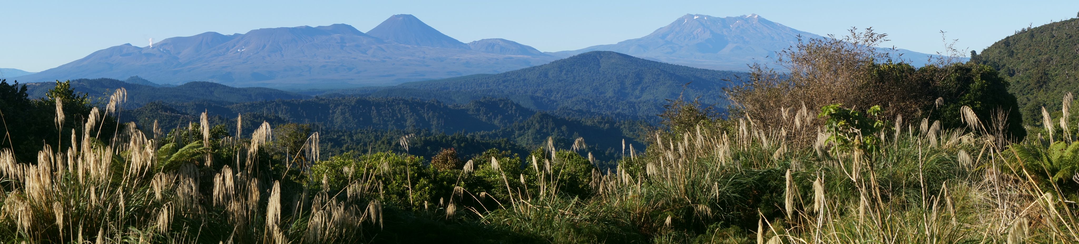
The road climbed first through pasture land and then into thick wet forest, I had just missed a dump of rain. Eventually a saddle was reached and a short, very steep narrow road lead up to a view point where the Tongariro volcanoes were partically obscured by cloud. There was a man here hanging out by his car. He said he was a hunter and was waiting there for sounds of deer or gunfire from other hunters. I thought about camping here and night time-lapsing Tongariro at night from the lookout but night visitors seemed likely so I continued on.
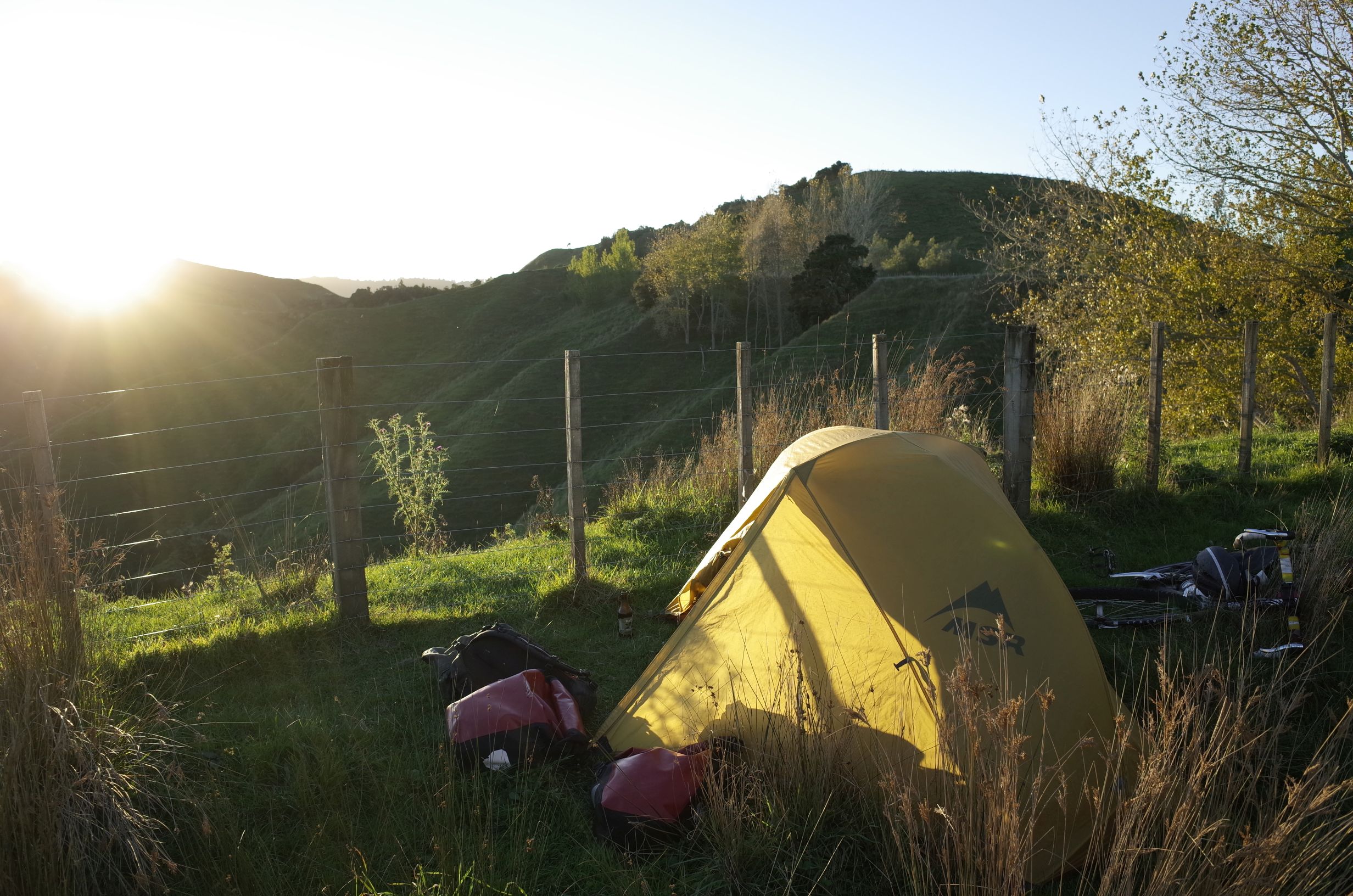
The light was fading and I descended off the viewpoint back to the main road and then down westward. After a while I found a decent looking place to camp, just hidden from the road and with a great view back towards Tongariro, Ngaurahoe, and Ruapehu.
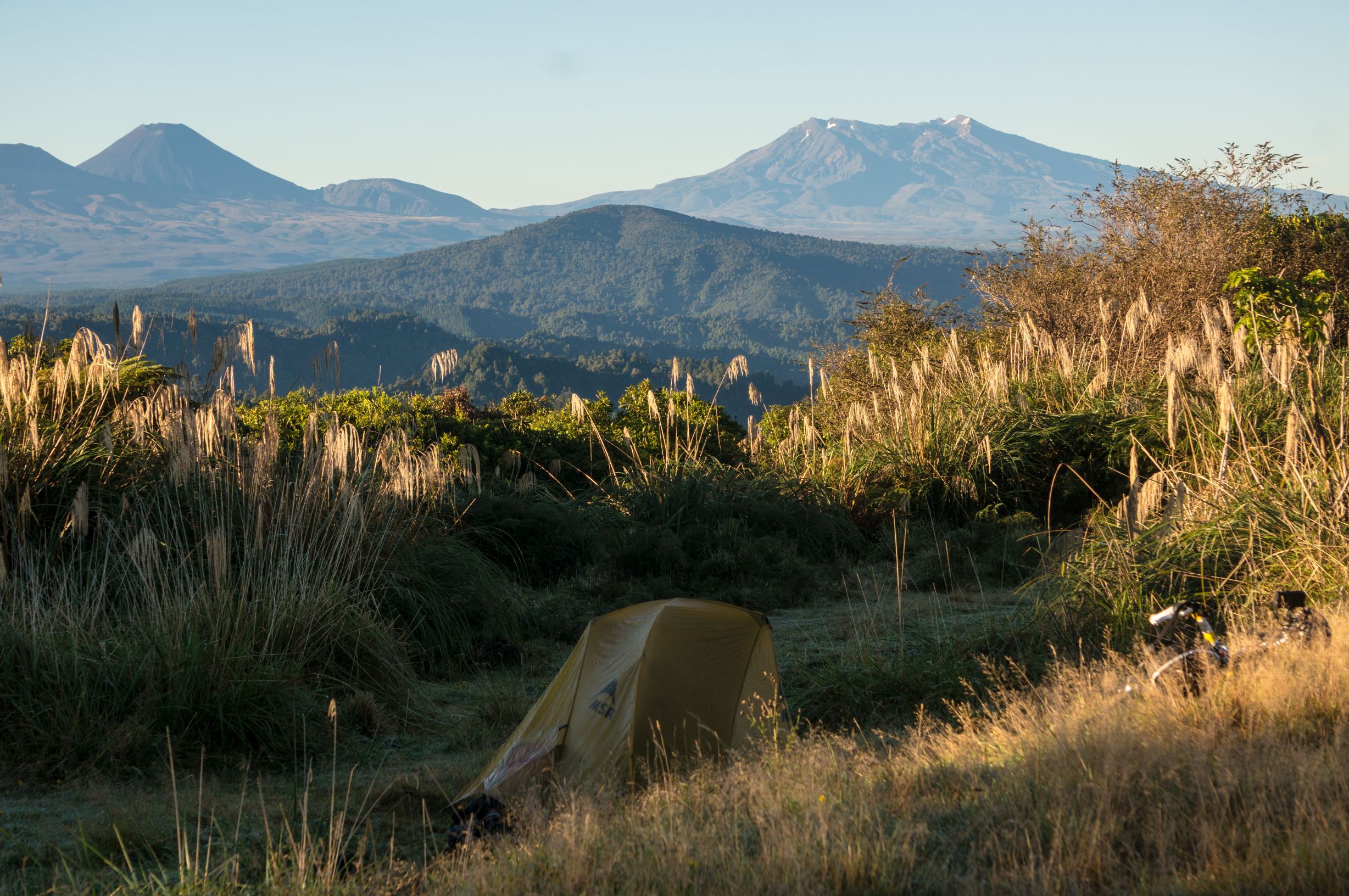
Now I was fairly confident that I would not be interrupted during the evening in this high location on the edge of a huge forest, with no nearby habitations, but I was very mistaken. To explain what happened I’ll quote an e-mail I sent to a friend:
“I camped at this place that had an amazing view back to the mountains. I thought that no one would turn up but I was wrong. A small cart with ranger-type people came along but they seemed happy to see me and said it was fine to camp. They were actually trying to catch hunters who were hunting illegally on their land.” There was a car parked, partially hidden in the trees across the road, I had not even noticed it but the ranger-types were confident it was an illegal hunter. “Then the police turned up, I was just setting up camp and doing a time-lapse. Then the hunter was caught by the police. One of the ranger-types wanted one of my pictures for his wall so I gave him my card. Then they all left except me and the caught hunter who was on a bank across the road. Then finally he left. It was all very unexpected and gave an idea of the conflict between hunters and larger scale hunting operators. I heard many deer during the night, also it was cold with a frost. There has been some snow on the highest mountains. Winter is not far away I guess. I now begin the Forgotten highway route to Taranaki”
It’s is not the best written explanation of what happen but you get the gist. The video made is below:
TONTIME video:
The night time-lapses from this night and the next night at farm ridge camp both feature in the time-lapse compilation below:
6 April (day 31): Hunters camp to farm ridge camp
It was a frosty morning, the temperature got to the point where I had to wear my clothes in the sleeping bag while also covering the sleeping bag with my jacket and anything else I could find. Actually it was not enough to stay warm but was only a real problem at the coldest part of the night (just before dawn). I packed up and set off down the hill to the west, cripes it was a nippy ride whizzing around the corners. At the bottom of the hill the road levelled and I gently rode into Taumaruanui, the real start of the Forgotten Highway. Well, as I entered the town I noticed the bike had developed a hobble in the rear. An inspection of the back tire revealed just how worn it had become, and a hole had developed in a side section. I really should have checked this earlier, “how could I be touring long distance and not notice something serious like this?” I thought. I would need a new tire before beginning the long Forgotten Highway so I rode up and down through along the main rode through the town. I was eyeing the train also because I was beginning to think that might be the way to get out of here with a broken bike. The town did not initially appear to have a bike shop, however I asked a guy on a bike and he told me there was one but it was inside the Honda motorbike shop. Sure enough there it was tucked at the back, a decently stocked bike shop. The young guy there first tried to fit a really fat tire on, but I decided against it and instead got a more sensible one. He warned me it would not last as long as the Swalbe Mondial, indeed it did not as it turned out, however for the moment I was elated to have the bike rideable again.
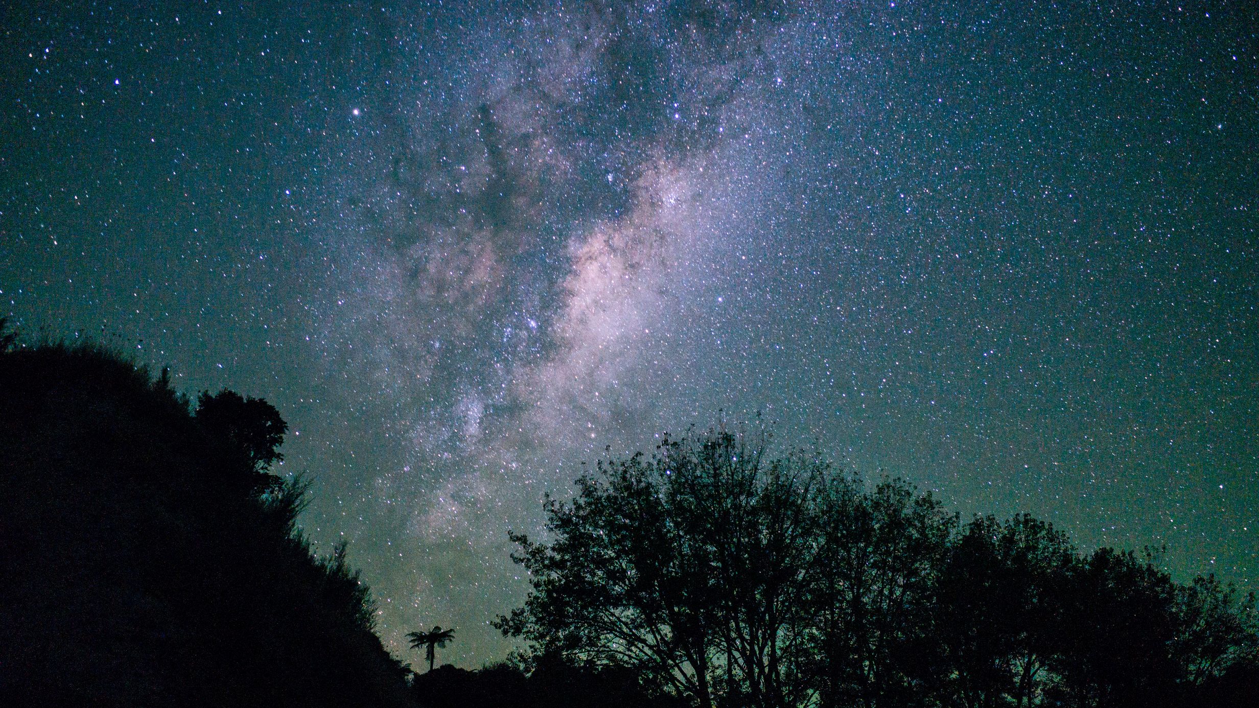
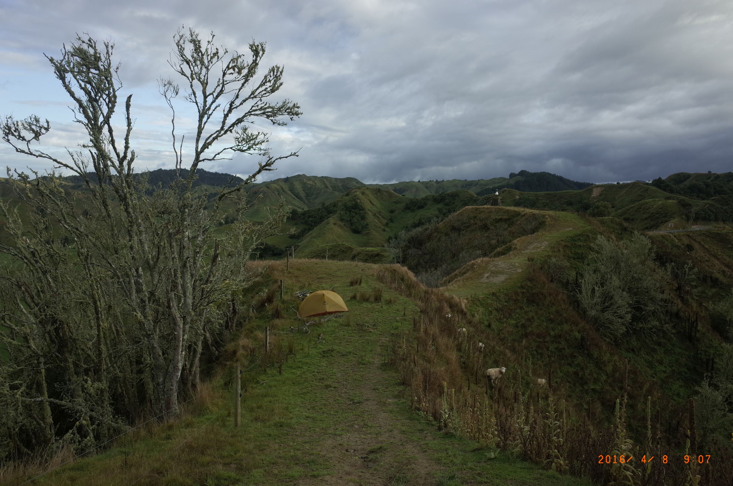
After Taumarunui I The Forgotten Highway began towards Stratford it by winding up the side of the Whanganui River and pretty soon there was a steep climb uphill followed by a steep descent and another hill and then several not that long Hills but very steep at times. In fact I had to walk the bike on a couple of occasions though thankfully there wasn’t much traffic on the road. Some sections had been eroded away in small landslides on the left. I carried on into the afternoon and eventually managed to find a place on a ridge to camp. It was farmland but I was relatively out of view, just tucked behind a little knob in the ridge. There were sheep in the valley and a farmer who was on his quad bike rounding up the sheep. I didn’t expect to be disturbed and I wasn’t. A second time lapse of the stars during the night it was a nice little fern just visible in the night. Fog moved in as you can see it in the time lapse bring the night so that leads into the next day.
7 April (day 32): Farm ridge camp to Strathmore Saddle camp
In the morning on the ridge there was fog. First it was clear it was down in the valley and then it kind of lifted up as the sun heated the sides of the hills. It looked like they were too inversion layers and as the sun heated up the slopes the fog moved from one inversion layer to the next, see time-lapse below.
I got cycling. The hills continued but it wasn’t as bad generally it was hard-earned pastural land. There was jagged topography with steep valleys, in a way a bit claustrophobic. There wasn’t much native bush, it mostly chopped down long ago. There were only very small communities.
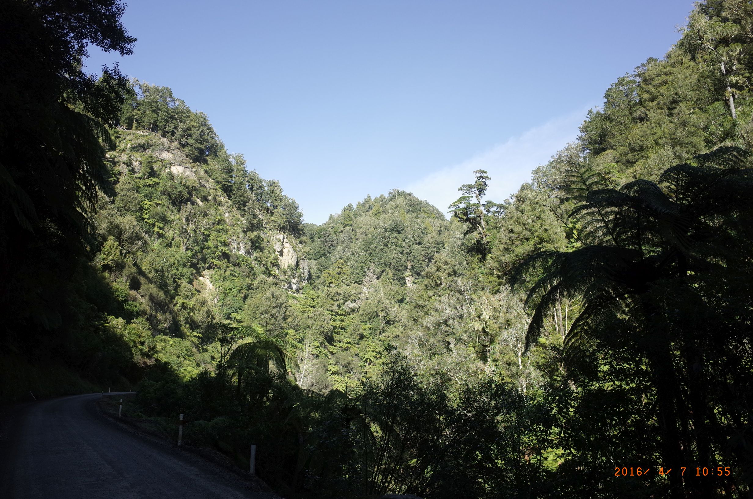
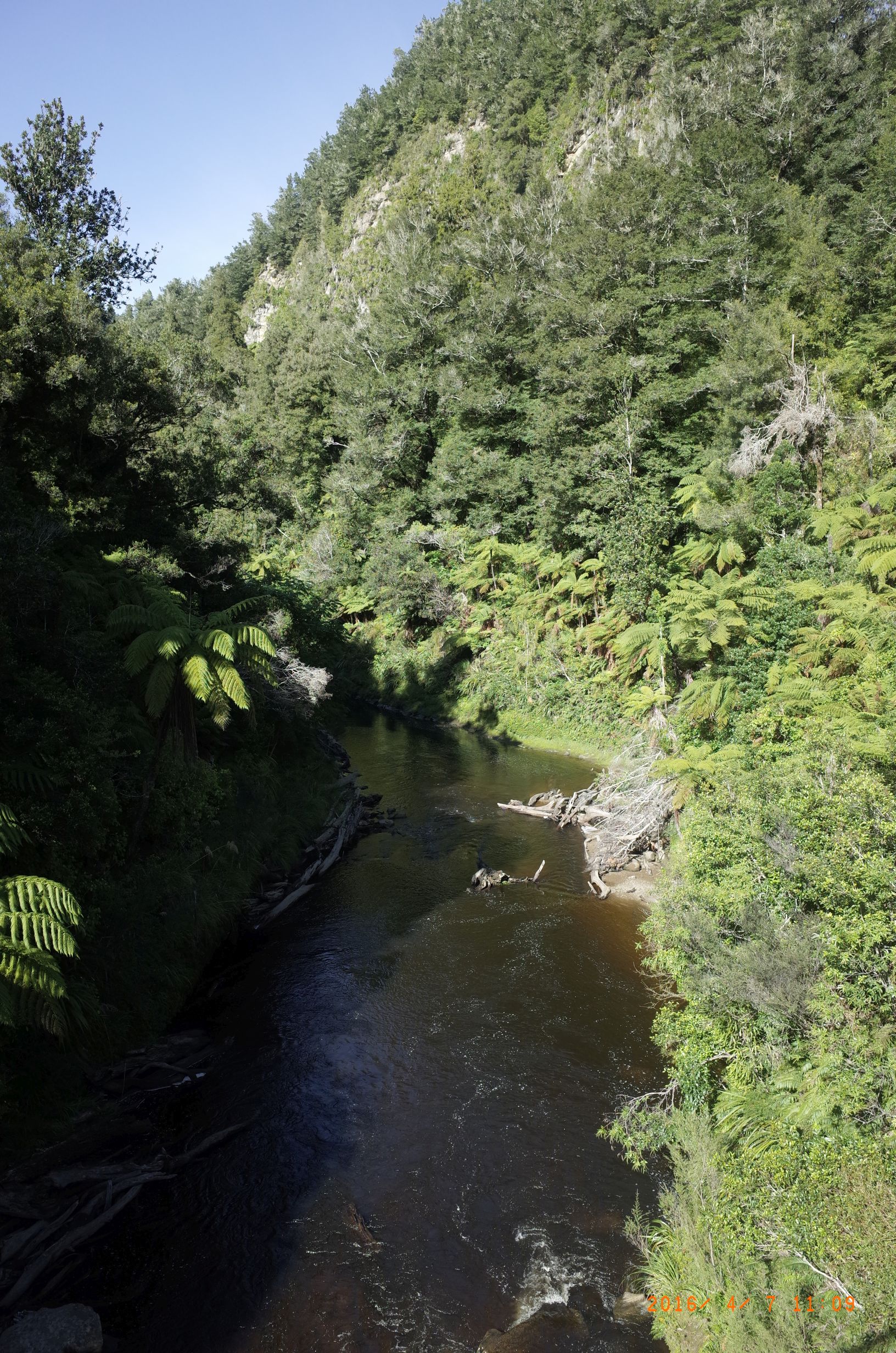
Next up was the Tangarakau Gorge section. Now this was thick bush in a stunning steep sided valley. The road was unpaved but actually was one of the easiest sections without any real hills and seemingly on a slight descent from this direction. For me this section was the highlight of the Forgotten Highway. I calculate 15 km of uninterrupted bush, a dramatic, and welcome change from the extensive pastureland.

After this was the famous Hobbits Hole single track tunnel. This must be interesting if you encounter a vehicle coming the other way but traffic is light enough for this to be a relatively unusual occurrence I guess. Did not happen to me, but I did not waist time in the tunnel.

I got to the Republic of Whangamomona where I went through the town before turning around in search of water. Well then I thought I’d better go to the pub here because I’ve seen it in a brochure and it was a republic after all. I don’t know the story of how there came to be a republic here. The pub I got a really nice beer it was called the republic beer but it was good I swear and in the pub they were playing music queen and REM.

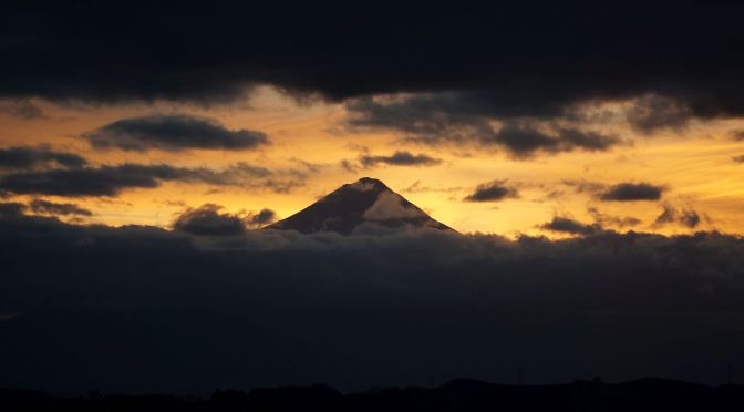
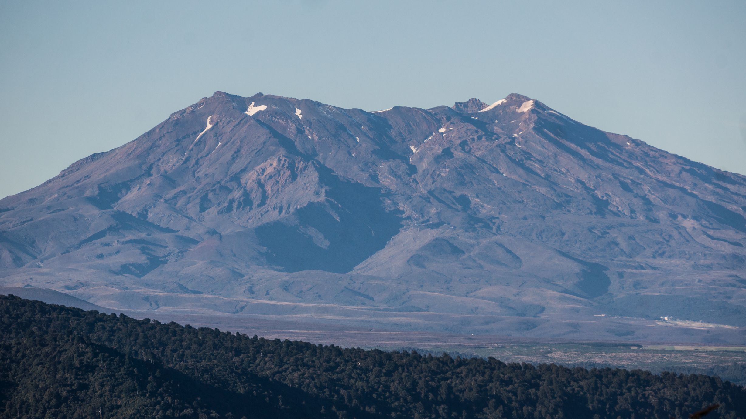
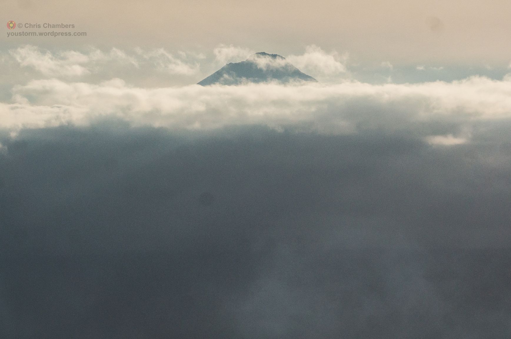
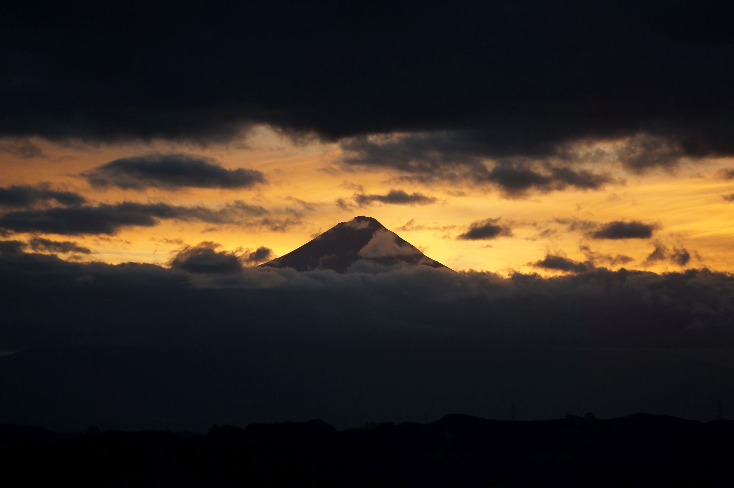
I had not listened to much music for a long time and so when Man on the Moon by REM came on the juke box, it lodged in my head for pretty much the rest of the New Zealand trip. From this point onwards I sang it on the hills get me going, my battery was too unreliable on the phone to use it as a Walkman. I got an opportunity to sing immediately because another steep hill lead out of Whangamomona. Eventually as the afternoon progressed I had to find somewhere to camp in I approached Strathmore saddle another steep climb and had read in the brochure that there was a view to Mt Taranaki from the top. Sure enough as I got to the top of the saddle there was a gap in the ridge and there was Mount Taranaki.

I decided the camp up on the saddle or at least try and I found a gate that had a path, well more of a cattle trail, that led along the ridge to a view point. I walked along the ridge dragging the bike then a bit further a resonable place to camp. There was a house in the valley that might have been able to see me, but I figured there was not much chance of having any problem camping there. The evening view to Mt Taranaki was impressive, here’s the time lapse:
My only concern with the place was the possibility of a raging torrent of cattle coming through in the early hours of the morning but it seems unlikely and I had a good night sleep.
8 April (day 33): Strathmore Saddle camp to Stratford
In the morning there was a nice view to Mt Taranaki with clouds pouring over. The time-lapse below shows this and also there is a rotor cloud that moves in from the left (south, moving eastward)
I then dragged the bike along the actually quite exposed and muddy ridge. Then was a steep descent from the saddle followed by some flat sections and another final hill. Finally an easy country ride lead into Stratford with Mount Taranaki towering above.

What an amazing place! I got some food in a take away and then I decided I will check out the holiday park which was pretty small. The owner was an English lady was in her final month working there after twenty years. She had quite the collection of China plates and dolls giving the reception a homely feel. The camping place had a couple of dog turds as well as a street light beeming down during the night. It wasn’t the best but I actually ended up spending a few days here. I had reached my destination, the base of Mount Taranaki, I had dreamed of getting here and was excited of what lay ahead.
The route for these 4 days is here (climb of 3782 metres!):
http://www.mapmyride.com/routes/view/1191857311
