
7 June 2016: beach camp to Byron Bay
I awoke to see quite clearly just how close the large wave runup had got to my tent at high tide. They had overtopped the sand cliff and got within just a few metres of my tent which stood on a small pocket of dry sand.

The tide was lowish and I had to bike just 3 km along the beach to get to Brighton. On the way were just a few of these impressive shells, this one was occupied.

At Brighton there actually were people, out walking their dogs on the beach. I left the beach here via an access path, and biked back to the Pacific Highway and then off left to Byron Bay. The surf was still amazing and I could see why Byron draws the tourists with the huge bay and coast backed by bush-clad mountains.

Out there somewhere was my camp the previous night. I booked into a cheap motel here and did laundry, and had evening beer and curry.

8 June: Byron Bay to Broadwater coast camp
I headed south out of Byron Bay up the coast 35 km to Ballina where I caught a ferry to get to South Balina.

On the ferry, the captain said “Where ya heading?”. “Umm” I hesitated “Melbourne!” “Melbourne?!” he responded. He then suggested “There’s a bladdy plane dan the road, it’ll get ya ta Melbourne in two ahhs”. Then another guys said “You need some money for a bus ticket?”.
Things were more peaceful heading south along the left bank of Richmond River which lead into Broadwater National Park.

I headed back down to the coast and found a great place to camp.


The beach had been so badly eroded by the storm that it was quite difficult to get down to the beach and rocks. I’m not sure but I think the rocks in the tent picture below (9 June morning) would have been mostly covered in sand prior to the storm. There were a lot of coastal shrub birds here enjoying the evening insects.


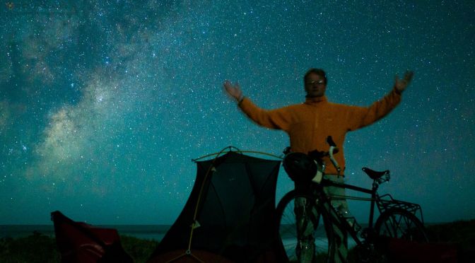
It was a sparklingly clear night, I took a milky way time-lapse although unfortunately nothing in the foreground.
9 June Broadwater coast camp to Angourie mosquito camp

Riding the beach from my camp to Evans Head might have been doable but there were a lot of exposed rocks and so I decided against it. Instead I headed inland and then south To Evans Head to stock up on food. I really wanted to go through Bunjalung National Park and Google Maps cycling directions suggested that there was a way through the park to eventually get to Woody Head. Sadly this turned out to be a military area (another Google directions failure, one of many) and there was no legal way though. With no choice I headed 10 km inland to Woodburn and then followed the Pacific Highway south. This was a frustrating development however it did mean fast progress south for once. In fact I quickly knocked off 45 km on the highway, there was a shoulder and the route was mostly through bush but the trucks and cars ruined the vibe. A python had paid the price for perhaps a morning sunbathe on the road. Past Chatsworth I’d had enough of the dam highway and eyed a route along the coast from Yamba, looked like a walking path south from Angourie but I hoped I could ride it. It was another 20 km to Angourie from the highway. Past Yamba this road goes through some great palm wetlands. I found the walking track at the end of the road where surfers were packing up after their days surf.
It didn’t look cyclable, immediately beginning with stairs so I turned around and looked for a camp in the fading light. The place I ended up was in some mosquito infested forest. I didn’t like it but beggars can’t be choosers.
The route for these 3 days (also including the day before) is here:
http://www.mapmyride.com/routes/fullscreen/1168086550/


Great blog Chris. I’ll be following with much interest. My partner and I frequently cycle around the Sunshine Coast to Brisbane region, and we’re planning a bike trip from Brisbane to Ballina – maybe further- next year. It’s good to know there’s a ferry there at Ballina.
Cheers
Michael
LikeLike